Overview
Chichester District Council encompasses a population of 113,794 people according to the 2011 census and in April 2019 had 57,664 households. It covers an area of 546 sq. Kilometres.

Local Plan
Along with all councils across the U.K. CDC is required to produce a local plan to demonstrate how and where the houses required by central government will come from.
This plan has to be passed by a government inspector and reviewed from time to time. Our review is overdue so we cannot show where and how those houses will come from – about 640 per annum for the moment.
That means that there is a “presumption in favour” on the planners to approve large planning applications thus developers are rushing to get their applications approved and CDC have identified large areas of the Manhood Peninsula to deliver those houses.
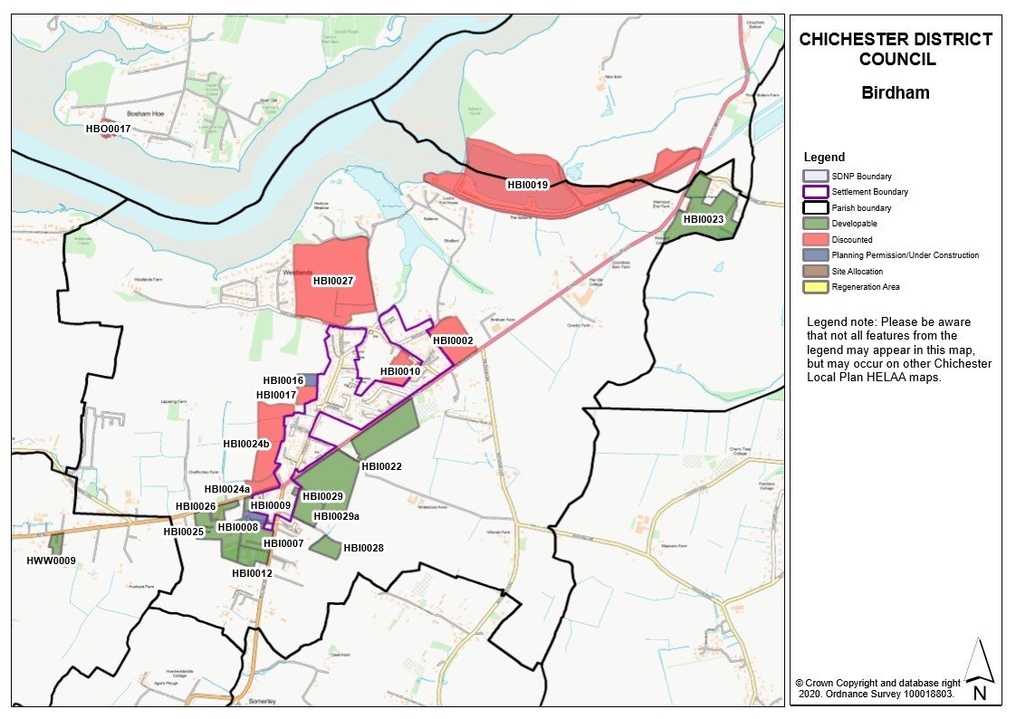
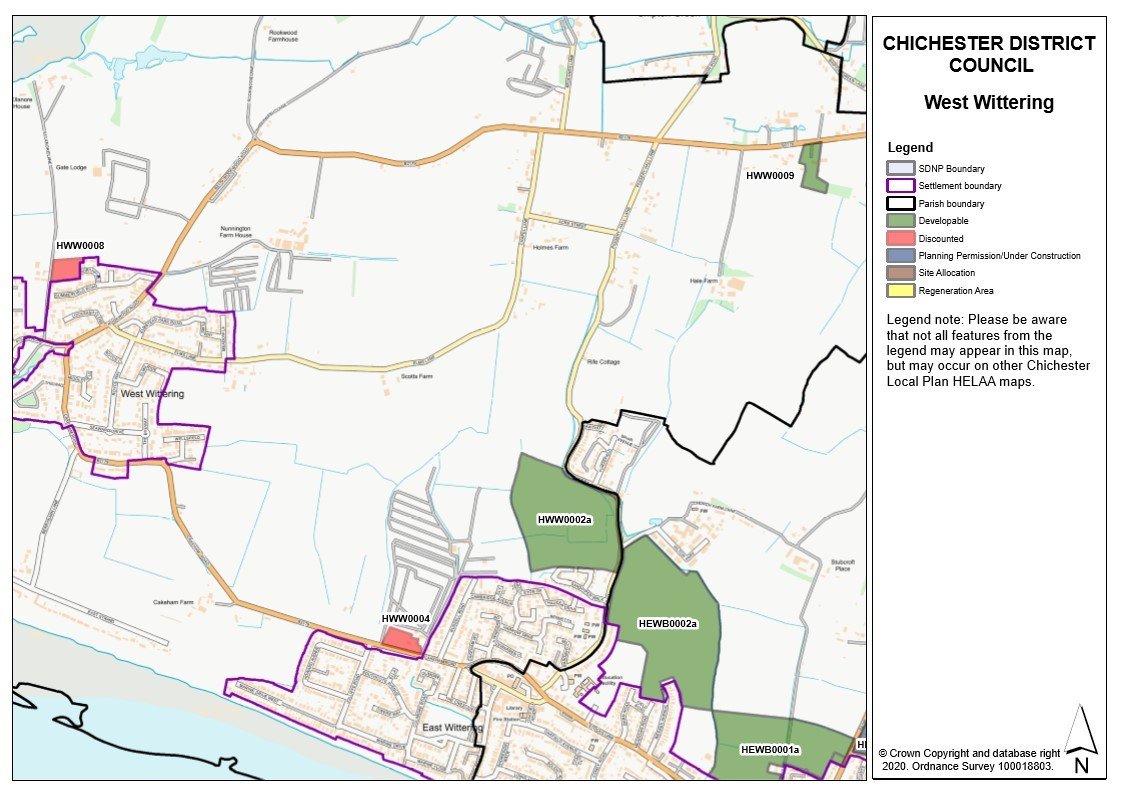
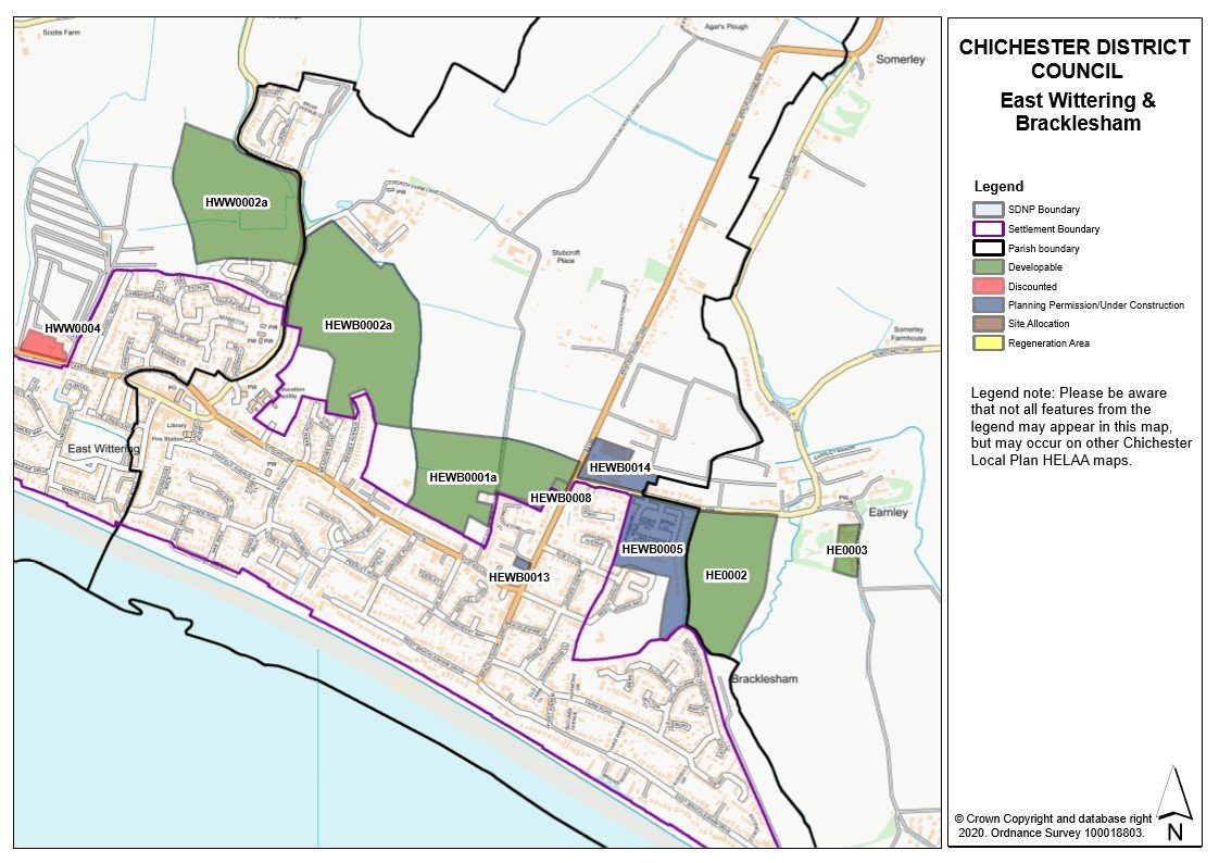
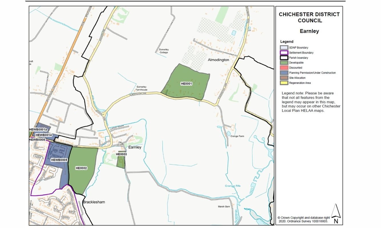
The Local Plan is critical and must be produced as soon as possible but is a huge piece of work. One of the early steps in the construction of the plan is to carry out a Housing & Economic Land Availability Assessment, more easily remembered as a HELAA. This is where local landowners offer up their land for development and estimate how many houses could be built thereon.
The council look at the offerings and decide if it is “Developable” within the timescale of the local plan and against certain parameters. If they think it is developable it is coloured green on the HELAA maps and CDC set out the numbers of houses/dwellings that they believe the land can support. This is an extremely simple overview of a very complex task. In due course we will add important links on the Manhope website as the Local Plan progresses.
Local Plan Review 3rd February to 17th March 2023
HELAA maps
The maps for the Western Manhood are shown below: